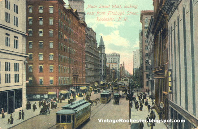
The Reynolds Arcade Building (on the north side of Main St with the little tower piece showing) is the most prominent landmark is this image. |
Sunday, July 10, 2011
Rochester NY 1910 - Main St West looking east from Fitzhugh St
Thursday, July 7, 2011
The Port of Rochester 1960
This is the Port of Rochester circa 1960. The Stutson Street bridge across the Genesee River is prominent in the picture. Notice the street car line on the west bank of the Genesee. |
Monday, July 4, 2011
Irondequoit Bay 1960
This is Irondequoit Bay as it appeared before the construction of the Irondequoit Bay Bridge. Bridge construction started in 1967 and finished in 1969. Wikipedia has a picture of the bay with the bridge http://en.wikipedia.org/wiki/Irondequoit_Bay_Bridge |
Sunday, June 19, 2011
Wednesday, June 15, 2011
Sunday, June 12, 2011
Rochester NY - Erie Canal Eastern Wide Waters 1906
| This area is the modern day Cobbs Hill Park in Rochester. Lake Riley at Cobbs Hill Park is the last vestige of the Erie Canal Eastern Wide Waters. |
Wednesday, June 8, 2011
Rochester NY - City Views from 1934
Court and Broad St Bridges over the Genesee River, Rochester NY 1934
Intersection of East Ave and East Main St, Rochester NY 1934
Monday, June 6, 2011
Tuesday, May 10, 2011
Wednesday, April 27, 2011
Saturday, February 26, 2011
Monday, February 21, 2011
Thursday, February 17, 2011
Subscribe to:
Comments (Atom)


